Next course begins November 4th

Introduction to ArcGIS

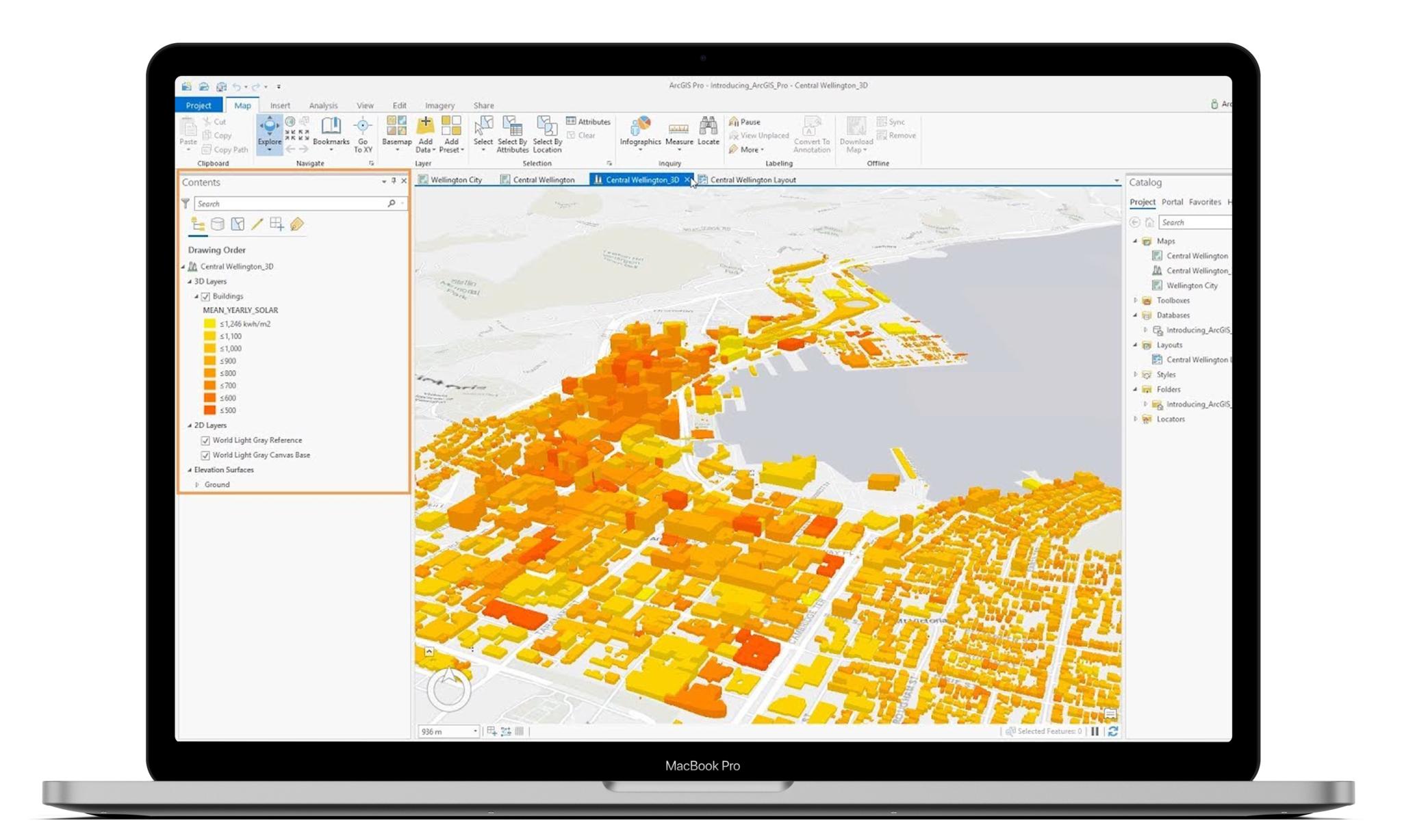
This course will introduce participants to the main principles and methods of Geographical Information Systems (GIS). It will inspect the processes in the capture, storage, manipulation, analysis, presentation and output of geographical data using ArcGIS. The course is intended for those who have little or no GIS knowledge.

What you'll learn

ArcGIS is a geographical information system (GIS) used by organisations to create, manage, share and analyse spatial data. The system provides an infrastructure for making maps and geographic information available throughout an organisation.

In this course you will be taught the basics for ArcGIS and give you the skills to develop and improve your map making. At the end of this course you will you will be able to create your own project, find location data and use techniques to create visualisations using GIS data within in an interactive map.

When you have completed your ArcGIS training you will have the skills, knowledge and confidence to start utilising the capabilities of GIS in your own projects.

Recommended Prerequisites: Participants must be confident in the use of the Windows operating system functions such as copying, deleting & moving files, navigating to a file or folder, use of Mouse and Keyboard.

Course Content

What is GIS?

  • Applications and uses of Geographic Information Systems
  • Database and GIS Theory
  • Basic GIS Concepts
  • Coordinate Systems
  • Data Types and Potential sources
  • What is Spatial GIS


Introduction to ArcGIS

  • ArcGIS History
  • What is Spatial GIS
  • Understanding ArcGIS versions
  • The ArcGIS Platform
  • Getting to know the ArcGIS Platform
  • Intro to ArcCatalog
  • Intro to ArcMap
  • Intro ArcToolBox
  • Intro to ArcScene
  • Intro to ArcGlobe
  • ArcGIS online
  • Signing into ArcGIS Online


Getting started with ArcMap

  • Expressions, Function and Variables
  • Working with Expression Editor
  • Using Functions in Charts
  • Using Variables in Expressions
  • Set Analysis and Set Expressions
  • Working with Master Items


Getting started with ArcMap

  • The ArcMap Interface
  • Spatial Bookmarks
  • Data Frame Properties
  • Data views and Layout views
  • Menus and Toolbars
  • Layer Files and map documents
  • Layer Tables
  • Layer Properties


Getting started with ArcCatalog

  • Overview of ArcCatalog
  • Connecting to data sources
  • Viewing and Modifying metadata


Understanding GIS Data

  • Turning geographic information into GIS data
  • GIS Data Models
  • Working with Tables
  • Table Types
  • Adding fields and records
  • Editing Values in a table
  • Selecting and sorting Table records
  • Joining and relating tables
  • Documenting your data
  • View Data in GIS
  • Add data to the map

Methods for obtaining GIS data

  • Making Selections
  • Selecting with SQL
  • Selections based on Location


Interacting with the Map

  • Symbology and visualisation
  • Getting information from a GIS Map
  • Exploring the map using ArcGIS
  • Navigate the map
  • Changing symbology
  • Identify features
  • Exporting selected features from a file to a geodatabase
  • Explore a map using ArcGIS Online
  • Navigate the map
  • Locate addresses and features
  • Select features and view an attribute table


Georeferencing

  • What is Georeferencing?
  • Georeferencing an image
  • Georeferencing of Images, Layers and CAD files


Geoprocessing

  • Extract Toolset
  • Overlay Toolset
  • Creating a Geoprocessing tool
  • Creating a Geoprocessing tool

Spatial Analysis Explained

  • Common Analysis tasks
  • Geoprocessing in analysis
  • How to perform spatial analysis with common analysis tools


Completing the Map

  • Introduction to the Map Layout view
  • Layout Toolbar
  • Changing layout style
  • Adding Layout components
  • How to add map annotation
  • How to add data timeframes
  • Using data frame properties
  • Previewing, printing & exporting
  • Layout templates


Sharing results

  • Importance of sharing results
  • Sharing content via ArcMap
  • Sharing your content via ArcGIS
  • Export the map as a PDF
  • Create a map package and upload it to ArcGIS Online

Summary

Upcoming Dates

LocationDatePrice
AccraNovember 4th, 2024₵6000

Delivery Methods

Classroom Training

Unlock your potential with our classroom training courses. Our portfolio of business intelligence training courses are delivered by BI experts across Africa.

Online Training

Our online trainings (live instructor-led) are delivered by certified instructors and are designed to replicate a classroom experience which enables full interactions.

Onsite Training

Our onsite training team allows us to bring our skills and expertise to you. Onsite courses are developed in conjunction with you, ensuring your expectations are exceeded.

1-to-1 Training

With our one-to-one training you’ll not only receive the undivided attention of the trainer, but one-to-one training allows you to tailor the training to your specific needs.

From ₦300,000
₵6000 | RF500,000

Certification

Refreshments

Training multiple people?

Empower your teams with business intelligence training courses delivered by subject matter experts.

Apply for Introduction to ArcGIS

Which date are you interested in?

Apply for Introduction to ArcGIS

Which date are you interested in?